Aerial precision
for every sector.
Six industries. One platform. Actionable aerial intelligence delivered with military-grade precision and cinematic quality.
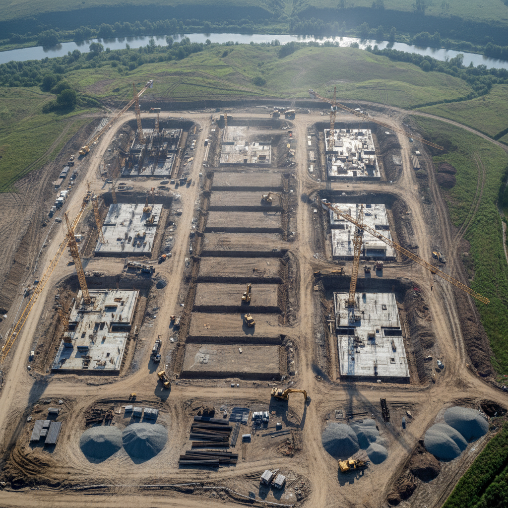
Build smarter with aerial intelligence
From groundbreaking to handover, our drones deliver weekly progress reports, volumetric stockpile calculations, and safety compliance documentation — replacing costly helicopter surveys at a fraction of the cost.
Request a DemoUse Cases
Progress Documentation
Weekly aerial captures tied to project milestones, shareable with stakeholders in 24 hrs.
Volumetric Calculations
Accurate cut/fill and stockpile volumes using photogrammetric point clouds.
Safety Inspections
Identify hazards, track PPE compliance, and document site conditions without halting work.
As-Built Surveys
Compare design models against actual construction with centimeter-level accuracy.
Key Benefits
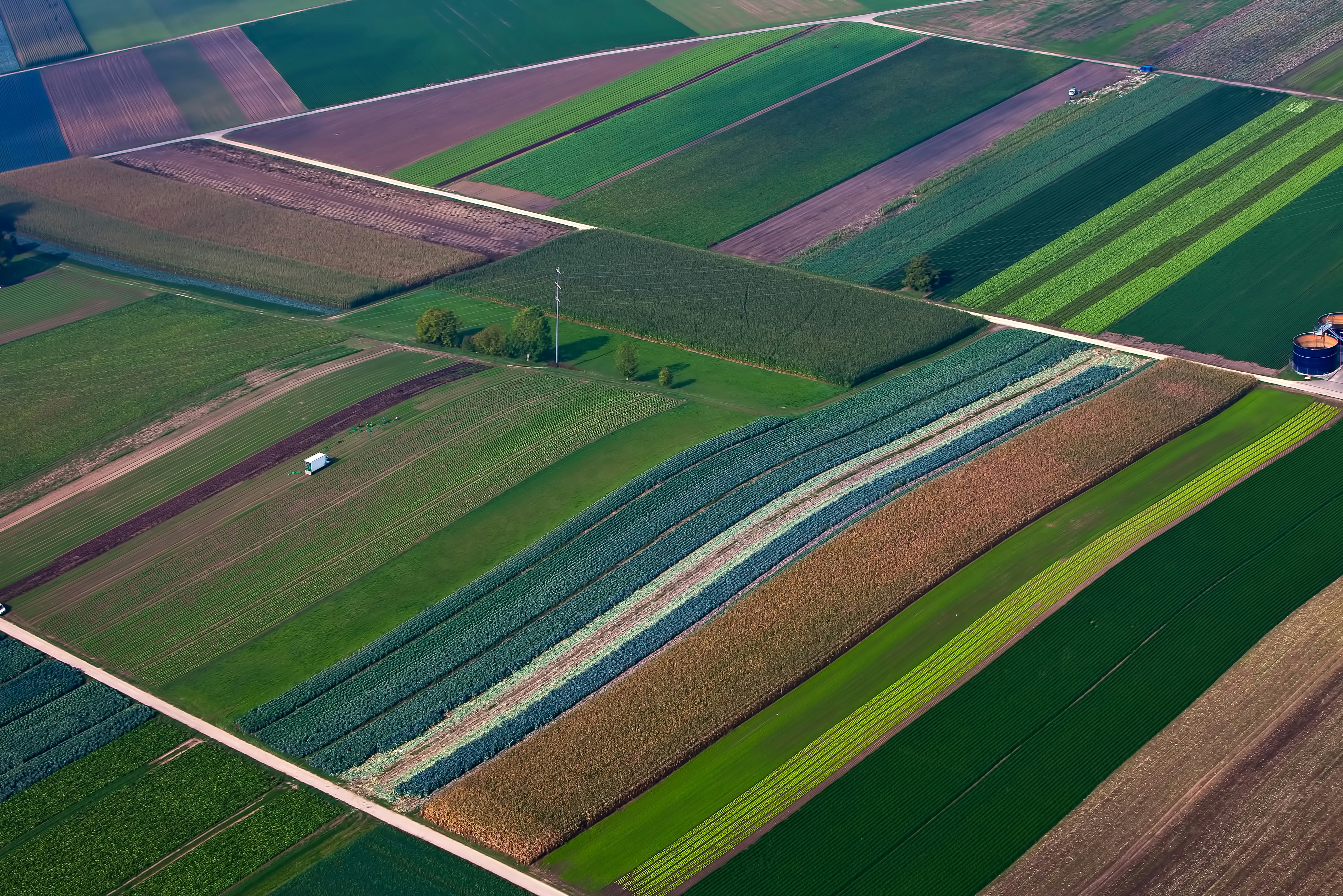
Turn crop data into yield gains
Multispectral and thermal imaging reveals what the naked eye cannot — crop stress, irrigation failures, and pest pressure — weeks before visible symptoms appear, enabling targeted interventions that protect yield.
Request a DemoUse Cases
NDVI Crop Mapping
Identify stressed zones with multispectral indices and generate variable-rate prescription maps.
Irrigation Audits
Thermal imaging pinpoints leaks, blockages, and under-watered zones across large acreages.
Pest & Disease Scouting
Early detection of fungal spread and insect pressure before economic thresholds are breached.
Yield Prediction
Canopy analysis models correlate with historical yield data for season-end forecasting.
Key Benefits

Sell properties before they hit the market
Buyers make decisions in seconds. Our 4K aerial walkthroughs, 360° virtual tours, and twilight photography create an emotional connection that ground-level photos simply cannot replicate.
Request a DemoUse Cases
4K Aerial Walkthroughs
Cinematic flyovers that reveal lot size, neighborhood context, and property features.
360° Virtual Tours
Interactive panoramas allowing remote buyers to explore every angle before visiting.
Twilight Photography
Golden-hour and dusk captures that make listings stand out in crowded portals.
Development Marketing
Pre-construction aerial renders and progress updates for off-plan sales campaigns.
Key Benefits
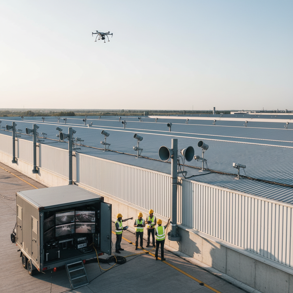
Eyes in the sky, intelligence on the ground
From perimeter security to crowd management, our thermal and optical payloads provide real-time situational awareness that ground teams cannot achieve — streamed live over 4G/5G to command centers.
Request a DemoUse Cases
Perimeter Security
Automated patrol routes with AI-triggered alerts for intrusion detection.
Crowd Monitoring
Event safety management with real-time density mapping and flow analysis.
Emergency Response
First-on-scene aerial reconnaissance for fire, flood, and search-and-rescue operations.
Critical Infrastructure
Power grid, pipeline, and water treatment facility monitoring with anomaly detection.
Key Benefits

Hollywood-grade aerial cinematography
Our gyro-stabilized 6K camera systems and experienced pilots deliver the sweeping, dynamic shots that define premium productions — from feature films and commercials to music videos and documentaries.
Request a DemoUse Cases
Feature Film Production
Complex tracking shots, reveals, and establishing sequences with DCI 4K RAW capture.
Commercial Advertising
Brand-aligned aerial narratives with same-day rushes for fast-turnaround campaigns.
Music Videos
Dynamic low-altitude and high-altitude choreographed moves synced to creative briefs.
Documentary & News
Rapid-deployment aerial coverage for breaking news and long-form documentary projects.
Key Benefits

Inspect assets without scaffolding
Bridges, towers, pipelines, and wind turbines can now be inspected in hours rather than weeks. Our AI-assisted defect detection flags cracks, corrosion, and anomalies with millimeter precision — no rope access required.
Request a DemoUse Cases
Bridge Inspection
Deck, soffit, and pier inspection with photogrammetric 3D models for structural analysis.
Wind Turbine Inspection
Blade surface analysis detecting micro-cracks and leading-edge erosion before failure.
Pipeline Monitoring
Thermal leak detection and right-of-way encroachment monitoring across hundreds of miles.
Transmission Tower Inspection
High-voltage line and tower inspection without power outages or climbing risk.
Key Benefits
Your industry.
Our expertise.
Tell us about your project and we'll match you with the right drone solution, crew, and deliverables.